Ita
Ita


Landscapes: conceive, analyzing and evaluating
Evolution of the concept of landscape and generating principles


In the nineteenth century, the biologist Patrick Gaddes proposed a new concept based on the balance between city and nature, thus laying the foundations for the concept of landscape and landscape planning as we currently know it.
The innovative principle of the concept of landscape is brought into relation in its complexity and richness, suggesting the extrinsic characteristics in which the city, which is part of it, develops.
With this principle we find the basis for the subsequent European Landscape Convention adopted by the Committee of Ministers of the Council of Europe in 2000 and signed by the member states of the organization in Florence on 20 October 2000.
Art 1 paragraph a. “Landscape” designates a specific part of territory, as perceived by populations, whose character derives from the action of natural and/or human factors and their interrelationships
The rapid and casual growth of the city and extra-urban rural space generates interesting problems, stimulating resolution proposals through various professionals and scholars who focus on the relationship between built and open space.
Thus, the need to safeguard landscapes from excessive and indiscriminate exploitation develops. All this led Europe to define what are the first “natural parks” with the objective and purpose of protection and scientific study.
From this perspective, what are defined as the “panoramic and scenic values” to be preserved for the benefit of the enjoyment of the entire population over time are identified and safeguarded. The first protection initiatives were mainly of an aesthetic nature, as they envisaged the limitation of the use of the territory in an almost entirely exclusive manner.
The first regulations regarding landscape protection and protection were issued in Germany in 1935, with the first plans for environmental protection on an urban and regional scale. The latter, drawn up in 1960, highlighted the characteristics of protection in relation to the study of soils, water, plants and animals in urban and regional contexts.
Grüne Charta
In 1961 in Germany, a group of scholars and political figures structured a document called the Grüne Charta which is summarized in 12 points which are current in the conception of the general theme of landscape protection and are:
- Spatial planning is punctuated by binding laws at all planning levels taking into account natural conditions.
- Preparation of landscape plans and greenery plans for all municipalities, settlement and industrial areas and road and infrastructure plans.
- Creation of recreational garden spaces, free access to forests and mountains, lakes, rivers and other naturalistic and landscape beauties; recreational spaces in urban areas for both leisure and holidays.
- Develop and ensure sustainable agriculture; the planning of rural settlements.
- Restoration and protection of the natural environment, soil, climate and water.
- Greater measures for the conservation and sustainable use of existing natural or artificial greenery.
- The prevention of avoidable interventions that damage the landscape.
- The remediation of unavoidable interferences, especially the greening of wastelands.
- Raising awareness of the population on the topic of landscape through public information on its importance in the city and in the countryside, and its dangers and threats
- Establishment of greater consideration of the landscape theme through training and education courses.
- Research into complementary natural habitat-related scientific disciplines and fields.
- Appropriate regulatory provision to promote and guarantee lifestyle attitudes and measurement of appropriate spaces.
A fundamental aspect of landscape planning takes into account the principles of ecology, in this regard it is possible to point out Vittorio Ingegnoli who in his book “fundamentals of landscape ecology (1993)” defines the main objective of landscape ecology as: the effect of the spatio-temporal configuration of the processes that occur within the landscape and which create links between the structure and the functions contained therein.

In recent years the theme of the landscape has taken on significant relevance, which places as its main element the new complex problems of choices between alternatives within the same sphere of protection: problems of management, redevelopment, planning and design, legislation, skills and actions towards the landscape and verification of the compatibility procedures for the use of the pre-established land.
On the basis of the results obtained in the territorial realities, on the qualities and on the Genius Loci, transformation interventions can be planned in line with the compatibility of the context.
Landscape analysis
Objective analysis considers the set of “objectively detectable” data, whether biotic or abiotic, spontaneous or anthropogenic, which constitute the structure of the landscape.
No science alone can explain the reality of a landscape and its totality; at the same time it presents itself as a unitary and uniform result of complex interactions; the individual analyzes to be conducted must therefore be used and structured separately and in an integrated way in order to identify the relationships between the different phenomena and delve into the continuously evolving dynamic aspect of the landscape through systemic approximation.
The detection of territorial, natural and anthropic data is analyzed in fundamental analytical paths. The data is collected according to geomorphology, exposure, geology, pedology, hydrogeology, vegetation cover, phytosociology and further analyzes to identify the vulnerabilities or vocations of the territory to determine uses of the same.
Anthropic data concern the human activities to be analyzed such as the type of residence, industrial plants, crops, services, traces of culture and traditions of the place.
Depending on the importance of their impact on the specific territory, they can be defined as “thematic maps” which can be used as summary elaborations aimed at the intended use of them.
To allow easier collection of data on the territory, it is divided into more or less extensive areas or areas depending on the characteristics of the morphology of the places or the purposes of the study.
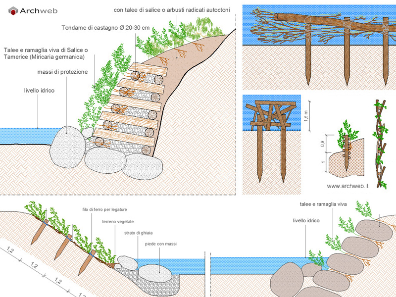
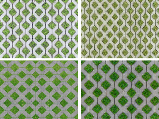
One method used is based on spatial computer analysis. For example, soil analysis can show a multitude of types of land, each with different properties and altitudes, based on this characteristic we can define the stability or danger of erosion, or the capacity for water absorption and fertility, the presence of organic material that contributes to the development of plants, etc…
Soil analysis is of great importance for the planning of a site, its permeability, stability or risk of erosion directly influences the choice of foundations for building, agricultural production and the location of anthropic activities.
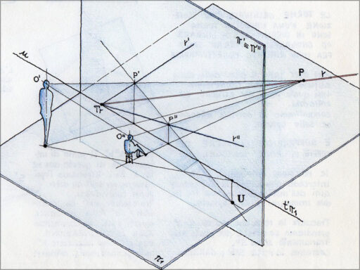
The subjective analysis, on the other hand, is mainly based on a visual process: the landscape is shown to the observer according to different reading layers such as: shapes, sequences, sensitive and perceptible orders, where the considerations are attributed to the concept of landscape object and arising from perception.
The investigation methodologies are mainly based on perceptual-visual analysis based on the enhancement of the “scenic qualities” of natural parks, for the landscape redevelopment of road routes, the evaluation of the visual impacts of new works on the landscape and so on.
The fundamental principles are:
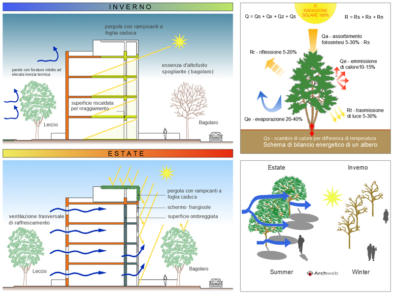
- The observation points, if located in an elevated position, allow for a wider view and good visibility conditions; from these places it is possible to grasp the layout and orientation of the expanses of water, identify the relationship between the naturalistic and anthropic elements, the main diversities of the landscape and the major landscape ensembles.
- The position of the observer with respect to observed objects influences the data and information of the landscape in order to perceive the most important things in reality; it is therefore advisable to precisely define the position of the observer (high, medium or low position) in relation to which it is moving or stationary.
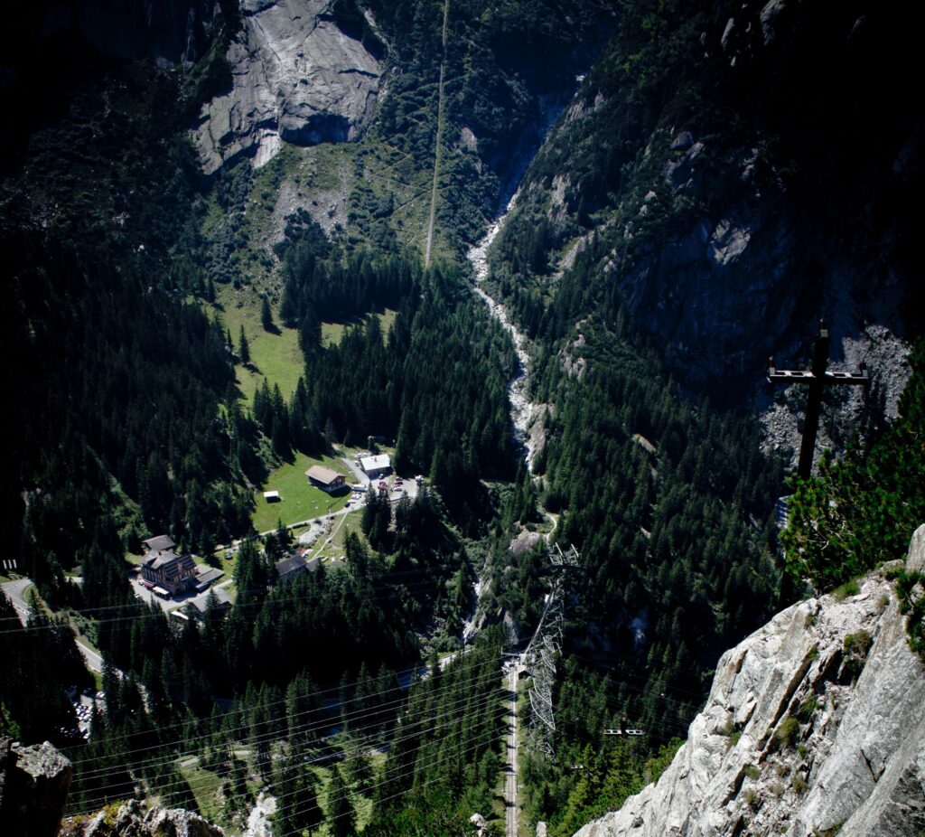
In the landscape study, different visions are also generally identified based on the depth that arise from the different levels of perception: foreground, second floor and background plane.
The foreground extends for a few kilometers and we can distinguish the textures, the aggregated macro shapes, we can perceive the color of the elements, the disorder and degradation of the landscape. It will allow you to read the texture of the soil and the different crops, the type of vegetation such as arboreal or shrubby, the materials used by the different fields.

In the second floor, most of the elements seem to come together, the design groups appear as a continuous extension, the eye no longer grasps the details but identifies the subjects clearly even if isolated based on the contrasting color spots, distinguishes the relationships among the masses their forms and their structure. The field of vision widens and valleys, plateaus and the distinctive features of the landscape itself are identified. It will be possible to grasp the shapes of water surfaces, the design of urban agglomerations and the diffusion and type of settlement.
The background planes are those furthest from the observer’s point of view and in certain cases they can appear almost uniform, the components of the landscape appear less and less distinct, making the resolution of the perceived elements low.
It will be possible to observe the general shape of the territory, the extent of vegetation cover, etc.
For the evaluation of visibility conditions, the study of the visual basin is important, i.e. the portion of territory visible from the place where the observer is located.
The variables that come into play can be the orography and morphology of the territory which can hide or mask certain points depending on the position and angle from which the observer observes, plant elements or structures placed along the dividing line. The implicit deduction of this observation is the visualization of the relationship between the existing and the observation point.
Sometimes it is possible to expand the limited visual basin thanks to particular visual corridors, i.e. those specific portions of territory visible exclusively from one point.
The analysis of a visual reservation of the landscape must be conducted with reference to three main sectors of investigation to appreciate the completeness:
- Inventory is the description of the elements visible in the portion of the landscape relating to the visual basin. It can refer to four fundamental classes of elements that make the landscape visible and their interactions with each other, namely: the shape of the land, the vegetal cover, the bodies of water, the anthropic transformations and superpositions, the interrelationships between the previous ones.
- Vulnerability, or the physical and formal capacity of a landscape to be prone to transformations and proposals while maintaining its character and visual qualities.
- Quality of the visual environment.
In this regard, the study of the EIA and the recent safeguard regulations integrates and completes the landscape study and analysis phase that we will see later in the next articles.
To learn more about EIA – Environmental Impact Assessment click here
References
G. Oneto Landscape Planning Manual, Milan, il sole 24h, 1997
K. Sale, The regions of nature, Milan, Eleuthera, 1991
P. Picarolo, Public and private green spaces, Ulrico Hoelpi Milan, 1999
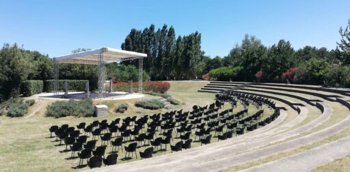
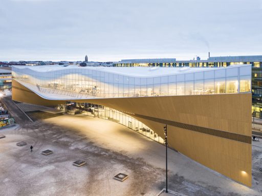
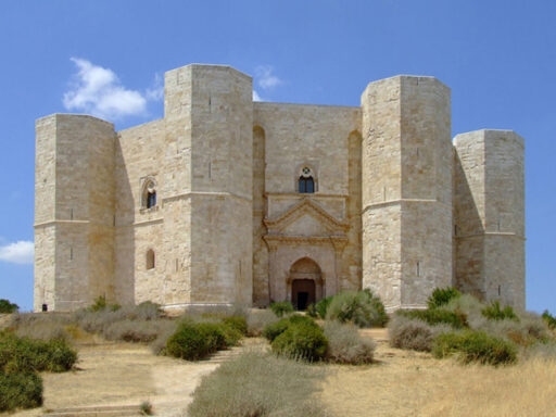
Cover photo: Silas Baisch on unsplash