Ita
Ita


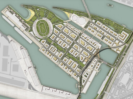
Urban planning terminology
Urban planning terminology. Glossary of the main urban terms
St (sqm) – Land area:
Perimeter surface in the P.R.G. feasible by means of an implementation urban plan, generally including the building surface and the green and public use areas.
It (mc / mq) – Territorial manufacturability index:
It defines the maximum building volume on each unit of land area, excluding the volume relating to urbanization works.
Ut (sqm / sqm) – Land use index:
Defines the maximum gross floor area (S.L.P.) achievable for each unit of territorial surface.
Dt (inhabitants / ha) – Territorial density index:
It defines the maximum number of theoretical settlers for each unit of territorial surface expressed in hectares (1 ha = 10,000 m2).
Sf (sqm) – Land area:
By land area we mean the surface of the building lot net of surfaces for primary and secondary urbanization works. In the land area, the areas to be used for construction, pedestrian paths and possibly private parking areas are identified.
If (mc / mq) – Land building index:
It is the ratio (m3 / m2) between the achievable volume and the area to be built, excluding road sites, even if private or to be sold to the Municipality.
It then defines the maximum building volume on each unit of land area.
Iv (mc / inhabitant) – Average building volume per inhabitant:
Variable according to the intended use, as a rule, for residential areas, it varies between 100-150 cubic meters / inhabitant.
Uf (sqm / sqm) – Land use index:
Defines the maximum gross floor area (S.L.P.) achievable for each unit of land area.
Df (inhabitants / ha) – Land density index:
It defines the maximum number of theoretical settlers for each unit of land area expressed in hectares.
Dc (ml) – Minimum distance of buildings from the property border:
It is determined by measuring the distance between the projection of the external surfaces of the perimeter walls of the building, net of the open projecting bodies, and the property boundary at the closest point of the building itself.
Dff (ml) – Minimum distance between buildings:
It is determined by measuring the minimum distance between the walls net of the open projecting bodies (Ministerial Decree no. 1444/1968). The municipal regulations specify the distances, in the various homogeneous areas, when different from the national standard.
Ds (ml) – Minimum distance of buildings from the road:
It is determined by measuring the distance of the building from the roadside, net of the open projecting bodies. By roadside we mean the limit line of the roadway including all roadways, both vehicular and pedestrian and the areas of road relevance (ditches, drains, etc.) (dmn 1404/1968; dmn 1444/1968; New Code della Strada, Legislative Decree no. 285/1992).
H (ml) – Maximum height of buildings:
Defines the maximum real height allowed.
It is measured from the average height of the sidewalk along the main front of the building, to the maximum height of the intrados (unless otherwise prescribed by the building regulations indicating the extrados) of the roof slab of the last habitable floor.
Height of a building:
is the maximum height between those of the various fronts of the building itself, measured:
- from the floor of use in front of the front up to the intrados of the last floor, for buildings with flat roofs or with slopes up to 35%;
- from the usage plan to the midpoint of the roof structure if this has slopes greater than 35%;
- in the case of buildings located along sloping land, the height is normally measured at the midpoint of the front.
Virtual H (ml):
It is the conventional height value, which multiplied by the GFA, quantifies the volume of a building regardless of its actual height.
Sc (sqm) – Covered area:
Covered area means the horizontal projection of the parts built above ground, with the exclusion of:
• projecting bodies (balconies, eaves, cornices, etc. with overhang not exceeding 1.20 m or as specified by local legislation;
• canopies covering the entrances (if less than 8-10 square meters of surface);
• parts of the building completely underground;
• outdoor pools and tanks, threshing floors, fertilizers and cultivation greenhouses.
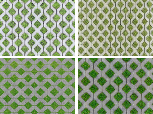
Filtering surface (sqm):
By filtering surface we mean the one arranged in green, not built either at the level of the pavement or underground.
GFA (sqm) – Gross floor area:
Gross floor area means the sum of the gross floor area of each floor of the building measured within the external profile of the perimeter walls of the various floors and intermediate floors, both above ground and underground.
The surfaces used for the shelter of cars, with the relative spaces for maneuvering and access, cellars, open overhangs (terraces, balconies, loggias), arcades, non-habitable attics and the technical volumes of the building are normally excluded from the calculation. . In the case of basement floors, the areas used for laboratories, offices, warehouses and meeting rooms must be taken into account (always see local regulations).
Occupied area (sqm):
Occupied area means the covered area increased by any basement quota – including the ditches -, exceeding the covered area, and the projection of arcades, even if not calculated for the purposes of the covered area. The areas destined to lanes and vehicle ramps, surface parking lots and consolidated pedestrian paths contribute to form the occupied surface.
Up (sqm) – Usable area of the accommodation:
The useful area of the accommodation means the floor area measured net of the perimeter and internal walls, pillars, doorways and French doors, ventilation or flue pipes, any chimneys, shafts, stairs uncommon internal and lodges.
Sp (mq) – Parking area:
This refers to the area to be allocated to garages or covered parking spaces pertaining to the housing organization, including maneuvering spaces.
The parking area (Sp) must be contained within 45% of the usable living area. The 45% limit is not intended for single accommodation but refers to the total useful surface (Su) of the housing organization.
The aforementioned percentage may be waived in the presence of housing structures consisting mainly of dwellings with a useful living area (Su) of less than 60 square meters.
Rc (%) – Coverage ratio:
It defines the maximum amount of covered area (Sc) in relation to the land area of the lot (Sf). Rc = Sc / Sf. It basically determines how much of the lot can be occupied by buildings and how much left free as uncovered space.
Rf (%) – Permeability ratio:
It defines the minimum quantity of filtering surface, that is the minimum quantity of the lot surface to be maintained or green with the exclusion of any building, including underground, or paving, expressed as a percentage of the Sf.
Ve (mc) – Building volume:
It is understood as the product of the sum of the GFA of the individual floors of the building for the virtual height, conventionally equal to 3 m. It is a value that may vary from municipality to municipality (for example the R.E. of Milan provides a virtual height of 3 m, in Rome instead of 3.20 m), regardless of its actual height.
The maximum volume that can be built in a building sector is also deducted on the basis of the building density indices allowed by the P.R.G. for that area, i.e. by multiplying the St or Sf respectively by It or If.
The buildable volume includes:
• the above ground part of existing buildings and / or to be built on the lot;
• the underground part of the same buildings, if intended for residence, offices or production activities;
• ancillary buildings, for their part above ground.
Technical volumes or anything else defined by municipal regulations (e.g. R.E. of Milan: stairwells) are excluded from the calculation of the buildable volume.
The buildable volume is calculated from the ground level to the intrados of the roof slab of the highest living space, including the attics, any porticoed areas for private use, balconies and closed projecting bodies (also in this case the standard may vary according to the municipal RE).
The buildable volume is expressed in cubic meters see also Cubature.
Eaves line:
The eaves line is the line determined by the intersection of the intrados of the roof pitch with the front of the building.
In the case of flat roofs, the roof slab is conventionally meant by pitch.
If the roof does not project, the intersection point of the roof intrados with the front of the building is the eaves line.
Technical Volume (mc):
Each volume refers to parts of the building that do not fit organically into the overall volume of this but are in practice superimposed on it, adjacent and sometimes interpenetrated. Examples:
The overtravel of the lifts, stair towers, water cabins, above solar roofs, other special systems (television, ventilation, etc.). The volumes relating to storage rooms, laundries, drying racks, etc. are not commonly considered technical volumes. wherever located.
Empty for full:
Thus said, in general, of a criterion for measuring the building volume that disregards the rigorous calculation of closed and open parts, approximating the real volume to that of a simple geometric shape within which the building can be enclosed.
Other common terms used in the study and planning of urban areas:
Urban planning: The process of defining policies and strategies for the development and management of urban areas, taking into account social, economic and environmental aspects.
Zoning: The division of an urban area into different zones or districts, each with specific rules for land use, such as residential, commercial, industrial, agricultural, etc.
Land use plan: An official document that defines the guidelines for the physical development of an urban area, establishing rules for land use, building height, infrastructure, green spaces, etc.
Commercial zone: An area designated for commercial activities, such as shops, shopping centres and restaurants.
Industrial zone: An area set aside for industrial activities, which may include factories, warehouses and production facilities.
Green zones: Open spaces or parks within urban areas, intended for public greenery, recreation and leisure.
Urban mobility: The management of transport within cities, which may include public transport systems, roads, cycle paths and traffic issues.
Population density: The number of housing units or people per unit area in an urban area. It can influence the built environment, traffic and quality of life.
Participatory planning: An approach in which citizens and stakeholders are involved in the decision-making process regarding urban planning and development.
Urban regeneration: The process of transforming and redeveloping degraded or underused urban areas in order to improve their appearance and functionality.
Sustainable Development Zones: Designated areas where development that balances social, economic and environmental aspects is encouraged to promote long-term growth.
Landscape constraint: Restrictions imposed on certain types of development or modifications in order to preserve the aesthetic and cultural appearance of an area.
Sustainable Urban Mobility Plan (SUMP): A strategic plan that aims to improve mobility in cities through sustainable solutions such as efficient public transport, promoting walking and cycling, and reducing vehicular traffic.
Urban infrastructure: The networks of essential services such as roads, sewers, drinking water and electricity that support the habitability and functionality of cities.